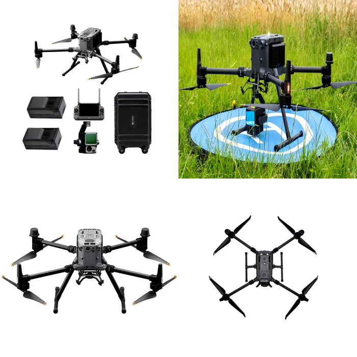
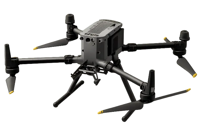
The DJI Matrice 350 RTK equipped with the Zenmuse L1 payload is an enterprise-grade UAV-based LiDAR system designed for high-precision 3D mapping, terrain modelling, and geospatial data acquisition.
It integrates LiDAR scanning, high-accuracy RTK GNSS positioning, inertial measurement, and an RGB mapping camera into a single platform, enabling the capture of dense, georeferenced point cloud datasets with centimetre-level accuracy.
The system combines LiDAR sensing with RTK positioning and IMU-based trajectory correction to deliver accurate spatial datasets, even in challenging environments such as dense vegetation or complex terrain.
It is particularly suited for applications where conventional photogrammetry is limited, including canopy penetration, corridor mapping, and detailed terrain modelling.
Key Highlights
- Integrated LiDAR + RGB + IMU system for simultaneous 3D mapping and imagery
- High-density point cloud generation (up to ~240,000–480,000 points/sec depending on configuration)
- Long-range LiDAR detection (up to ~450 m in optimal conditions)
- Centimetre-level positioning accuracy using RTK GNSS
- Extended flight endurance (~55 minutes) for large-area coverage
- High payload capacity (~2.7 kg) for multi-sensor deployment
- IP55-rated platform for operation in demanding environments
- Omnidirectional obstacle sensing for enhanced flight safety
- O3 Enterprise transmission system (up to ~15 km under optimal conditions)
- Advanced automated mission planning (e.g., waypoint and terrain-following missions)
Typical Applications
- LiDAR-based topographic mapping and terrain modelling
- ESIA baseline terrain and vegetation analysis
- Forest canopy penetration and biomass estimation
- Corridor mapping (pipelines, roads, transmission lines)
- Urban 3D modelling and digital twin generation
- Floodplain and hydrological modelling
- Mining volumetric analysis
Industries and Use Cases
- Environmental Consulting – terrain and vegetation analysis
- Oil & Gas – corridor mapping and right-of-way monitoring
- Mining – volumetric surveys and terrain modelling
- Infrastructure & Engineering – design and inspection
- Forestry & Agriculture – canopy and biomass assessment
- Urban Planning & GIS – 3D modelling and spatial analysis
- Government & Survey Agencies – geospatial mapping
Integrated Sensor Architecture Summary
The Matrice 350 RTK with Zenmuse L1 integrates:
- LiDAR scanning sensor (primary 3D mapping component)
- High-precision IMU (trajectory and orientation correction)
- RGB mapping camera (for point cloud colourisation and imagery)
- RTK GNSS positioning system (centimetre-level accuracy)
- Multi-directional vision and infrared sensing (collision avoidance)
- Aircraft-level IMU, compass, and barometer (flight stability)
This integrated system supports:
- Dense 3D point cloud generation
- Digital Terrain Models (DTM)
- Digital Surface Models (DSM)
- Infrastructure and corridor mapping
- Vegetation penetration analysis
Key Components & Sensor Specifications
LiDAR Sensor System (Primary Mapping Sensor)
- Measurement principle: Laser pulse time-of-flight
- Detection range: Up to ~450 m (high reflectivity conditions)
- Point cloud rate: Up to ~240,000–480,000 points/sec
- Multiple return capability (typically 3–5 echoes)
- Non-repetitive scanning pattern (Livox-based)
- Output formats: LAS/LAZ point cloud data
RGB Mapping Camera
- Sensor: ~20 MP CMOS
- Mechanical shutter (mapping-grade)
- Function: Orthomosaic generation and point cloud colourisation
Inertial Measurement Unit (IMU)
- High-precision IMU integrated within L1 payload
- Enables trajectory correction and accurate georeferencing
- Fully synchronised with LiDAR and GNSS data streams
RTK GNSS Positioning System
- Multi-frequency GNSS with RTK capability
- Accuracy:
- Horizontal: ~1 cm + 1 ppm
- Vertical: ~1.5 cm + 1 ppm
- Supports GPS, GLONASS, Galileo, BeiDou
Obstacle Detection & Safety Sensors
- Multi-directional vision sensors
- Infrared sensors for low-light detection
- Optional radar module for enhanced obstacle detection
Flight Stability Sensors
- Redundant IMU system
- Dual compass
- Barometer (altitude control)
- Multi-constellation GNSS receiver
Communication System
- DJI O3 Enterprise transmission
- Range up to ~15–20 km (conditions dependent)
- Real-time HD video and telemetry transmission
Compare with (i) DJI Mavic Air 2, (ii) DJI Mavic 3 Enterprise RTK and (iii) Autel EVO II Pro V2: (see table)
| Parameter | DJI Mavic Air 2 | DJI Mavic 3 Enterprise RTK | Autel EVO II Pro V2 | DJI Matrice 350 RTK (L1 LiDAR) |
|---|---|---|---|---|
| System Class | Compact prosumer UAV | Compact enterprise mapping UAV | Professional aerial imaging UAV | Enterprise LiDAR mapping UAV |
| Primary Use | Reconnaissance & visual documentation | Survey-grade mapping & inspection | High-resolution imaging & inspection | LiDAR-based 3D mapping & terrain modelling |
| Positioning System | Standard GNSS | RTK GNSS (cm-level accuracy) | Standard GNSS (no RTK) | RTK GNSS (cm-level accuracy) |
| Mapping Capability | ⚠️ Basic mapping only | ✅ Survey-grade photogrammetry | ⚠️ Mapping support (non-survey grade) | ✅ True 3D LiDAR mapping |
| Primary Sensor | 1/2″ CMOS, 48 MP | 4/3″ CMOS, 20 MP (mechanical shutter) | 1″ CMOS, 20 MP | LiDAR + RGB camera |
| Shutter Type | Electronic | Mechanical (mapping-optimised) | Electronic | Mechanical (RGB) + LiDAR scanning |
| LiDAR Capability | ❌ Not available | ❌ Not available | ❌ Not available | ✅ Full LiDAR system |
| Point Cloud Output | ❌ No | ❌ No | ❌ No | ✅ High-density (up to ~480k pts/sec) |
| Camera Capability | 48 MP photo / 4K video | 20 MP + zoom camera | 20 MP + 6K video | ~20 MP RGB mapping camera |
| Zoom Capability | Digital only | Up to ~56× hybrid | Digital (~8×) | Not primary function |
| Flight Time | ~34 minutes | ~45 minutes | ~40 minutes | ~55 minutes |
| Coverage Efficiency | Low–moderate | High | Moderate | Very high |
| Obstacle Avoidance | Forward / backward / downward | Omnidirectional | Omnidirectional | Omnidirectional + optional radar |
| Transmission System | OcuSync 2.0 (~10 km) | DJI O3 Enterprise (~15 km) | Dual-band (~9–10 km) | DJI O3 Enterprise (~15–20 km) |
| Payload Capacity | Fixed camera | Fixed camera system | Fixed camera system | ~2.7 kg (multi-sensor capable) |
| Operational Complexity | Low | Medium | Low–medium | High |
| Portability | Very high (ultra-compact) | High | High | Moderate |
| Accuracy Level | Metre-level (GNSS) | Centimetre-level (RTK) | Metre-level (GNSS) | Centimetre-level (RTK LiDAR) |
| Best Use Case | Quick reconnaissance & site documentation | Mapping, surveying, inspection | Visual inspection & high-quality imaging | LiDAR mapping, terrain modelling |
| Performance in Vegetated Areas | Limited | Limited | Limited | ✅ Strong (LiDAR penetration) |
What UAV systems do you deploy?
- DJI Mavic Air 2 (rapid reconnaissance)
- DJI Mavic 3 Enterprise RTK (survey-grade mapping)
- Autel EVO II Pro V2 (high-quality imaging)
- DJI Matrice 350 RTK + Zenmuse L1 LiDAR (advanced terrain/3D mapping)
Which UAV should I use for my project?
Project Need → Recommended UAV
- Quick site inspection / visuals → Mavic Air 2
- High-quality imagery / inspection → Autel EVO II Pro V2
- Survey-grade mapping → Mavic 3 Enterprise RTK
- Dense vegetation / terrain modelling → Matrice 350 RTK (LiDAR)
Is the Mavic Air 2 suitable for mapping?
It supports basic photogrammetry but is not survey-grade due to lack of RTK. Best for visuals and preliminary mapping.
What makes the Mavic 3 Enterprise RTK different?
RTK delivers centimetre-level accuracy, enabling:
- Orthomosaics
- Photogrammetry
- High-accuracy corridor/infrastructure mapping
What makes the Matrice 350 RTK with L1 LiDAR unique?
LiDAR enables:
- True 3D terrain mapping
- High-density point clouds
- Vegetation canopy penetration (better than photogrammetry in dense cover)
Can EcoPro provide UAV data processing and analysis?
Yes. We provide:
- Photogrammetry processing
- LiDAR processing
- GIS integration
- Technical reporting
Are your UAV operations compliant with regulations?
Yes. EcoPro operations follow:
- Nigerian aviation requirements (project dependent)
- International safety and best practice procedures
- Client/project-specific compliance rules
Can EcoPro deploy multiple UAV systems on one project?
Yes. We deploy multi-UAV solutions based on scope, terrain, timeline, and required accuracy.