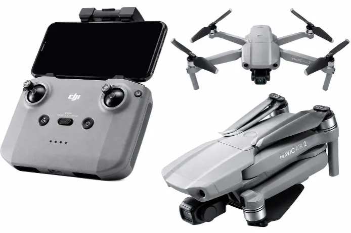
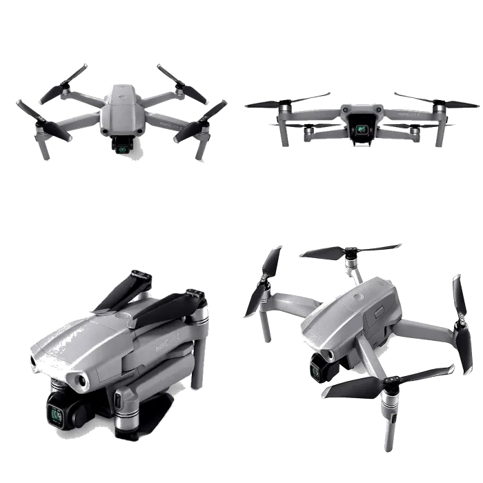
The DJI Mavic Air 2 is a compact unmanned aerial system (UAS) designed for aerial imaging, site reconnaissance, and general-purpose environmental monitoring.
It integrates a high-resolution camera, intelligent flight systems, and extended flight time within a portable platform suitable for rapid deployment.
The platform provides high-quality visual data acquisition for mapping, inspection, and documentation applications. While not survey-grade, it is suitable for preliminary assessments and visual analysis in ESIA and infrastructure projects.
Key Highlights
- 48 MP camera with 4K video capability
- Flight time of up to ~34 minutes
- OcuSync 2.0 transmission (~10 km range under optimal conditions)
- Obstacle avoidance system (APAS 3.0)
- Automated tracking and flight modes
- Compact, foldable design (~570 g)
Typical Applications
- Site reconnaissance and visual inspection
- ESIA site documentation
- Construction monitoring
- Basic aerial mapping
- Infrastructure inspection
- Disaster assessment
Industries and Use Cases
- Environmental Consulting – reconnaissance and documentation
- Construction – site monitoring
- Oil & Gas – corridor inspection
- Agriculture – land-use surveys
- GIS & Urban Planning – visual mapping
Integrated Sensor Architecture Summary
The DJI Mavic Air 2 integrates:
- High-resolution imaging sensor (48 MP CMOS)
- Forward, rear, and downward vision sensors
- Infrared/ToF sensors for altitude and proximity
- GNSS positioning system (GPS + GLONASS)
- Flight stability sensors (IMU, compass, barometer)
- AI-based tracking and navigation system (APAS 3.0)
Key Components & Sensor Specifications
| Component | Specification |
|---|---|
| Imaging System (Primary Data Acquisition Sensor) | |
| Camera Sensor | 1/2″ CMOS |
| Effective Resolution | 48 MP (also supports 12 MP standard mode) |
| Lens | 24 mm equivalent focal length |
| Field of View (FOV) | ~84° |
| Aperture | f/2.8 (fixed) |
| Shutter Type | Electronic shutter |
| Gimbal | 3-axis stabilized gimbal |
| ISO Range | 100–6400 (video); up to 6400 (photo) |
| Function | Aerial imaging, photogrammetry (basic), inspection, ESIA reconnaissance |
| Obstacle Avoidance & Vision Sensor System | |
| Forward Vision Sensors | Binocular vision system |
| Backward Vision Sensors | Binocular vision system |
| Downward Vision Sensors | Vision + infrared (ToF) sensors |
| Detection Coverage | Front, rear, and downward directions |
| Downward ToF Range | ~0.1 – 8 m |
| Hovering Range (Vision System) | ~0.5 – 60 m |
| Obstacle Avoidance System | APAS 3.0 (Advanced Pilot Assistance System) |
| Function | Collision avoidance, assisted navigation, terrain awareness |
| Navigation & Positioning Sensors | |
| GNSS Systems | GPS + GLONASS |
| Positioning Accuracy | ~±1.5 m (GPS standard) |
| Vision Positioning System (VPS) | Enabled for low-altitude stabilization |
| Function | Navigation, hovering stability, geotagging |
| Flight Stability & Motion Sensors (Core UAV Control System) | |
| IMU (Inertial Measurement Unit) | Multi-axis gyroscope and accelerometer |
| Compass | Integrated digital compass |
| Barometer | Altitude measurement sensor |
| Infrared Sensors | Downward altitude and proximity sensing |
| Function | Flight stabilization, orientation, altitude control |
| Intelligent Flight & Tracking Sensors (AI-Based System) | |
| Tracking System | ActiveTrack 3.0 (AI-based subject tracking) |
| Object Detection | Visual recognition using onboard vision sensors |
| APAS 3.0 | Real-time path planning and obstacle avoidance |
| Function | Autonomous navigation, tracking, and smart flight modes |
| Communication & Data Transmission System | |
| Transmission System | OcuSync 2.0 |
| Frequency Bands | 2.4 GHz / 5.8 GHz auto-switching |
| Max Range | Up to ~10 km (FCC conditions) |
| Live Feed | Up to 1080p HD |
| Function | Real-time video, telemetry, and command/control |
Compare with (i) DJI Mavic 3 Enterprise RTK, (ii) Autel EVO II Pro V2 and (iii) DJI Matrice 350 RTK (L1 LiDAR) :(see table)
| Parameter | DJI Mavic Air 2 | DJI Mavic 3 Enterprise RTK | Autel EVO II Pro V2 | DJI Matrice 350 RTK (L1 LiDAR) |
|---|---|---|---|---|
| System Class | Compact prosumer UAV | Compact enterprise mapping UAV | Professional aerial imaging UAV | Enterprise LiDAR mapping UAV |
| Primary Use | Reconnaissance & visual documentation | Survey-grade mapping & inspection | High-resolution imaging & inspection | LiDAR-based 3D mapping & terrain modelling |
| Positioning System | Standard GNSS | RTK GNSS (cm-level accuracy) | Standard GNSS (no RTK) | RTK GNSS (cm-level accuracy) |
| Mapping Capability | ⚠️ Basic mapping only | ✅ Survey-grade photogrammetry | ⚠️ Mapping support (non-survey grade) | ✅ True 3D LiDAR mapping |
| Primary Sensor | 1/2″ CMOS, 48 MP | 4/3″ CMOS, 20 MP (mechanical shutter) | 1″ CMOS, 20 MP | LiDAR + RGB camera |
| Shutter Type | Electronic | Mechanical (mapping-optimised) | Electronic | Mechanical (RGB) + LiDAR scanning |
| LiDAR Capability | ❌ Not available | ❌ Not available | ❌ Not available | ✅ Full LiDAR system |
| Point Cloud Output | ❌ No | ❌ No | ❌ No | ✅ High-density (up to ~480k pts/sec) |
| Camera Capability | 48 MP photo / 4K video | 20 MP + zoom camera | 20 MP + 6K video | ~20 MP RGB mapping camera |
| Zoom Capability | Digital only | Up to ~56× hybrid | Digital (~8×) | Not primary function |
| Flight Time | ~34 minutes | ~45 minutes | ~40 minutes | ~55 minutes |
| Coverage Efficiency | Low–moderate | High | Moderate | Very high |
| Obstacle Avoidance | Forward / backward / downward | Omnidirectional | Omnidirectional | Omnidirectional + optional radar |
| Transmission System | OcuSync 2.0 (~10 km) | DJI O3 Enterprise (~15 km) | Dual-band (~9–10 km) | DJI O3 Enterprise (~15–20 km) |
| Payload Capacity | Fixed camera | Fixed camera system | Fixed camera system | ~2.7 kg (multi-sensor capable) |
| Operational Complexity | Low | Medium | Low–medium | High |
| Portability | Very high (ultra-compact) | High | High | Moderate |
| Accuracy Level | Metre-level (GNSS) | Centimetre-level (RTK) | Metre-level (GNSS) | Centimetre-level (RTK LiDAR) |
| Best Use Case | Quick reconnaissance & site documentation | Mapping, surveying, inspection | Visual inspection & high-quality imaging | LiDAR mapping, terrain modelling |
| Performance in Vegetated Areas | Limited | Limited | Limited | ✅ Strong (LiDAR penetration) |
What UAV systems do you deploy?
- DJI Mavic Air 2 (rapid reconnaissance)
- DJI Mavic 3 Enterprise RTK (survey-grade mapping)
- Autel EVO II Pro V2 (high-quality imaging)
- DJI Matrice 350 RTK + Zenmuse L1 LiDAR (advanced terrain/3D mapping)
Which UAV should I use for my project?
Project Need → Recommended UAV
- Quick site inspection / visuals → Mavic Air 2
- High-quality imagery / inspection → Autel EVO II Pro V2
- Survey-grade mapping → Mavic 3 Enterprise RTK
- Dense vegetation / terrain modelling → Matrice 350 RTK (LiDAR)
Is the Mavic Air 2 suitable for mapping?
It supports basic photogrammetry but is not survey-grade due to lack of RTK. Best for visuals and preliminary mapping.
What makes the Mavic 3 Enterprise RTK different?
RTK delivers centimetre-level accuracy, enabling:
- Orthomosaics
- Photogrammetry
- High-accuracy corridor/infrastructure mapping
What makes the Matrice 350 RTK with L1 LiDAR unique?
LiDAR enables:
- True 3D terrain mapping
- High-density point clouds
- Vegetation canopy penetration (better than photogrammetry in dense cover)
Can EcoPro provide UAV data processing and analysis?
Yes. We provide:
- Photogrammetry processing
- LiDAR processing
- GIS integration
- Technical reporting
Are your UAV operations compliant with regulations?
Yes. EcoPro operations follow:
- Nigerian aviation requirements (project dependent)
- International safety and best practice procedures
- Client/project-specific compliance rules
Can EcoPro deploy multiple UAV systems on one project?
Yes. We deploy multi-UAV solutions based on scope, terrain, timeline, and required accuracy.